Myndtown
From Ars Magica
Contents |
Situation
Saxton Map: Myntowne
Myndtown sits immediately at the foot of the steep escarpment of the Black Knoll - the southwest extent of The Long Mynd, which immediately climbs over 200m in altitude. About 1kn to the SW is Myndmill Farm, on the Onny river, and almost 3 sm WNW of it lies Hardwick.
History
The area has been farmed since Bronze Age times, shown by the Bronze Age burial mounds along the edge of The Long Mynd above here.
Domesday
4 Land of Earl Roger
4,20 Holding of Picot under [{Earl Roger]]
Picot also holds in Rinlow Hundred
4,20,2 Myndtown (Mvnete). Leofric holds it from him. He held it himself, he was a free man. 1 1/2 hides which pay tax. Land for 3 1/2 ploughs. In lordship 1 1/2 ploughs; 2 slaves; 4 villagers and 4 smallholders with 2 ploughs. 1 hedged enclosure. Value before 1066, 60s; now 30s.
Post Domesday
The name derives from Munette (Mynd - mountain settlement).
A taxation list of 1291 puts it's value at under £4 per annum, but this wa reduced to an assessment of 30s on the wheat, wool, and lamb of the parish "because the lands lay fallow and untilled, the tenqants being poor".
Church
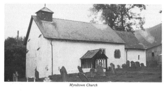
St John. A small roughcast-clad stone church, with no tower, sits in the centre of the settlement. The nave is Norman, and the chancel was built extending it in the 14th century. It was mentioned as a rectory in the time of Bishop Braose 1200-1216.
Castle
None

