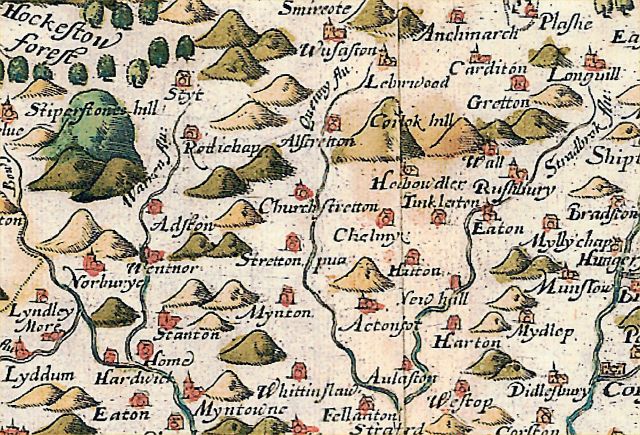
Around Church Stretton
From Ars Magica
The Saxton Map of 1577
This is a fairly early map of the area, showing it after the major population losses of the C14, but well before the coming of modern transport systems. It shows no roads. Hills and settlements are shown conventionally, without a serious attempt to represent them realistically.
Modern settlements from the Ordnance Survey maps
Modern settlements mapped onto the locations shown on the Saxton Map. Most of the settlements on the Saxton map can fairly easily be identified on modern Ordnance Survey maps. The accuracy of the modern maps does show one major area of distortion on the Saxton map. Settlements in the south-west area of the map appear significantly higher on the map than equivalent settlements further east.
Details of the modern settlements arelisted on the pages for the individual locations.
Locations shown on the Saxton Map (1577)
Saxton and modern names compared, together with Ordnance Survey grid references giving an etimate of the location of the settlement on modern maps.
| Saxton Map; | Modern Name | Easting | Northing | Key |
|---|---|---|---|---|
| Corlok Hill | Caradoc Hill | 477 | 955 | CH |
| Stiperstones Hill | The Stiperstone Hills | 368 | 985 | SH |
| Bow flu | River West Onny | |||
| Stradbrok flu | N to S Lakehouse Brook Eaton Brook Byne Brook | |||
| Camlet Flu (Lydham) | River Camlad | |||
| Quenny Flu | Quinny Brook | |||
| Warren Flu | River East Onny |

