File:Ipon map.png
From Ipon
(Difference between revisions)
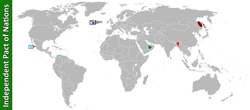
(Map of IPON) |
|||
| (One intermediate revision not shown) | |||
| Line 1: | Line 1: | ||
| - | Map of IPON | + | Map of IPON: [[Canatlán]](teal), [[Nemonos]](orange), [[Mesías]](blue), [[Liberty Islands]](navy), [[Khaled]](green), [[Jansipur]](red), [[Sakhaliya]](maroon). |
Current revision as of 06:33, 12 January 2008
Map of IPON: Canatlán(teal), Nemonos(orange), Mesías(blue), Liberty Islands(navy), Khaled(green), Jansipur(red), Sakhaliya(maroon).
File history
Click on a date/time to view the file as it appeared at that time.
(Latest | Earliest) View (newer 50) (older 50) (20 | 50 | 100 | 250 | 500).| Date/Time | Thumbnail | Dimensions | User | Comment | |
|---|---|---|---|---|---|
| current | 01:48, 15 December 2007 |  | 800×351 (135 KB) | Bokrif (Talk | contribs) | (Map of IPON) |
- Edit this file using an external application See the setup instructions for more information.
Links
There are no pages that link to this file.
