Wentnor
From Ars Magica
Contents |
Situation
Saxton Map: Wentnor
Wentnor sits on a hilltop location, 2km west of the western escarpment of The Long Mynd, between the southwards flowing Criftin Brook to the east, and the slightly larger River Easy Onny to the west.
About 1km to the east is Robury Ring, next to which is one of the many springs which bring water out of The Long Mynd, and which has been believed to be a holy well.
History
The settlement seems to have been formed in the Saxon period, as a small group of habitations around a green, surrounded by long thin communal fields divided into strips. The old English version of the name "Wantenoure" means "Wonta's or "Wenta's flat topped ridge".
Domesday
4 Land of Earl Roger
4,4 Holding of Roger Son of Corbet under Earl Roger
Roger also holds in Rinlow Hundred
4,4,4 Wentnor (Wantenovre). Edric held it, he was a free man. 2 1/2 hides which pay tax. In lordship 3 ploughs; 15 slaves; 5 villagers and 11 smallholders with 8 ploughs. 4 hedged enclosures. Value before 1066, £6; later 40s; now £4.
Post Domesday
At Domesday, it was the only manor in Rinlau Hundred to be held by Roger fitz Corbet. From 1093 he and his successors granted the patronage and tithes from Wentnor to Shrewsbury Abbey. Buildwas Abbey acquired Wentnor mill. Shrewsbury Abbey lost the right to present the incumbent after the twelvth century, although an annual sum of 5s continued to be payable to it.
Church
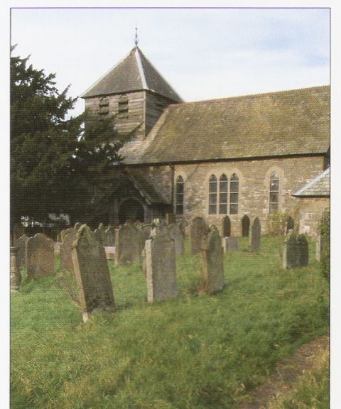
St Michael's church has Early Norman west and north walls, and a 12th century south doorway. The church looks out over lower land to the south. It is thoght that two earlier wooden churches at this site were burnt down.

