Template:Saxton Map
From Ars Magica
(Difference between revisions)
m (fixed bug) |
m (size back to 700px) |
||
| Line 3: | Line 3: | ||
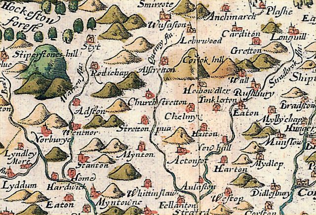
This is a fairly early map of the area, showing it after the major population losses of the C14, but well before the coming of modern transport systems. It shows no roads. Hills and settlements are shown conventionally, without a serious attempt to represent them realistically. | This is a fairly early map of the area, showing it after the major population losses of the C14, but well before the coming of modern transport systems. It shows no roads. Hills and settlements are shown conventionally, without a serious attempt to represent them realistically. | ||
| - | <div style="position: relative">[[Image:Stretton area.jpg]] | + | <div style="position: relative">[[Image:Stretton area.jpg|700px]] |
<!-- MAP MARKER TEMPLATE madness... --> | <!-- MAP MARKER TEMPLATE madness... --> | ||
{{Map Marker|z=Hockestow ForestF|x=42|y=31|}} | {{Map Marker|z=Hockestow ForestF|x=42|y=31|}} | ||
Revision as of 15:08, 8 March 2006
The Saxton Map of 1577
This is a fairly early map of the area, showing it after the major population losses of the C14, but well before the coming of modern transport systems. It shows no roads. Hills and settlements are shown conventionally, without a serious attempt to represent them realistically.

