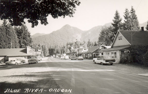
Blue River
From Lane Co Oregon
| (One intermediate revision not shown) | |||
| Line 5: | Line 5: | ||
Five miles northeast of the community, a dam on the Blue River forms the '''[[Blue River Reservoir]]'''. | Five miles northeast of the community, a dam on the Blue River forms the '''[[Blue River Reservoir]]'''. | ||
| - | [[Category:Lane County rivers]] | + | [[Image:BlueRiverTown.jpg]] |
| + | |||
| + | [[Category:Lane County rivers]] | ||
| + | [[Category:Cities]] | ||
Current revision as of 23:40, 17 October 2007
Blue River is an unincorporated community in Lane County, Oregon, United States. It is located on Oregon Route 126 and the McKenzie River, between the communities of Finn Rock and Rainbow, in the Willamette National Forest, where the Blue River empties into the McKenzie. The population is approximately 883.
The community is named after the Blue River, which is aptly named for the striking blue color that apparently comes from its rocky bed. The area was first settled in the late 19th century by the Sparks family. Gold was discovered in the Blue River area 1863, but by 1912, most gold mining activity had ended. The ore was low grade and the local stamp mills have not operated in many years. Records show, however, that the Lucky Boy Mine had extracted more than $1 million from the Blue River Mining District during the brief gold rush. Samuel Sparks and his sons laid out the town of Blue River in 1900 as part of 320 acres they had acquired. Blue River post office was established in 1886.
Five miles northeast of the community, a dam on the Blue River forms the Blue River Reservoir.

