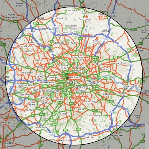
LNHSAreaMap
From Londonbirders
The 'London Area' is the recording area used by the London Natural History Society and is a 20 mile radius of St Paul's Cathedral, see map below:
To check the exact distance of any site you need to know the six figure grid reference, this can be done online using [1] - (click on the site and get the coordinates from the link at the bottom of the page). Copy the grid ref to [2] using TQ320811 (St Paul's Cathedral) as the other grid ref. This gives you the distance between the two sites in kilometres, divide by 1.6 to convert it to miles.

