Totteridge Valley
From Londonbirders
m |
m |
||
| Line 5: | Line 5: | ||
'''Habitat''' | '''Habitat''' | ||
| - | Habitat wise, the valley contains Darlands Lake, which is shallow and silted with willow/sallow carr at the northern end. The Folly Brook and Dollis Brook run through parts of the valley and there are additional ponds along Totteridge Lane ( | + | Habitat wise, the valley contains [http://www.streetmap.co.uk/map.srf?X=524325&Y=193355&A=Y&Z=115 Darlands Lake], which is shallow and silted with willow/sallow carr at the northern end. The Folly Brook and Dollis Brook run through parts of the valley and there are additional ponds along Totteridge Lane ([http://www.streetmap.co.uk/map.srf?X=523400&Y=194100&A=Y&Z=115 Long Pond]) and in Mill Hill ([http://www.streetmap.co.uk/map.srf?X=522500&Y=192850&A=Y&Z=115 Sheepwash Pond]). There are small patches of deciduous/mixed woodland at Oakfields, Mill Hill; Holecombe Dale, Mill Hill; behind St Paul's School in Mill Hill; and around Darlands Lake. |
[[Image:ISE_Darlands.jpg]] | [[Image:ISE_Darlands.jpg]] | ||
Revision as of 22:52, 10 December 2009
Location
Totteridge Valley lies immediately south of the A5109 running between Highwood Hill and Totteridge Village. See map:
Habitat
Habitat wise, the valley contains Darlands Lake, which is shallow and silted with willow/sallow carr at the northern end. The Folly Brook and Dollis Brook run through parts of the valley and there are additional ponds along Totteridge Lane (Long Pond) and in Mill Hill (Sheepwash Pond). There are small patches of deciduous/mixed woodland at Oakfields, Mill Hill; Holecombe Dale, Mill Hill; behind St Paul's School in Mill Hill; and around Darlands Lake.
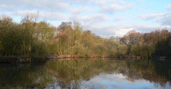
View of Darlands Lake (photo by Ian Ellis).
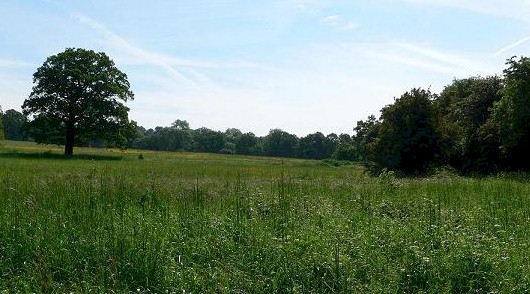
There are also plenty of ancient hedgerows remaining. Excluding residential areas and gardens, an estimated order of abundance of land use is pasture; arable farmland; rough grassland; sports related (football/cricket pitches & racetrack); water features.
Highwood Hill is the highest point not only within the valley, but also one of the highest points in Middlesex, reaching 442 feet (almost the same height as Hampstead Heath.
View north of Darlands Lake (photo by Ian Ellis).
Recording Boundaries
Whilst the valley lies entirely within LB Barnet, for LNHS recording purposes the valley is split with roughly equal portions lying within the old Middlesex county and the old Hertfordshire county. Basically, the land west of the Dollis Brook AND north of the Folly Brook is in Herts. The land south of the Folly Brook and the land east of the Dollis Brook is in Middlesex.
For the purpose of 'London Birders' local patch reporting, the definition of Totteridge Valley is the triangle of land whose boundaries are as follows: starting at Totteridge & Whetstone LU station, the Northern boundary is the A5109 heading West until you reach Highwood Hill; the Western boundary is the B552 down to Partingdale Lane and Lullington Garth; the Eastern boundary is the Northern Line between Lullington Garth and T&W station.
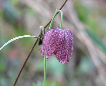
Snakeshead Fritillary, a special flower of the area (photo by Ian Ellis).
Species
Please refer to MonthlyHighlights2006 and/or the species list [1] for details of sightings since 1/1/06. During passage, chats, wheatears, pipits and yellow wagtails should put in the odd appearance and it is reported that Osprey has been seen in two recent years. Summer visitors to the valley include Hobby and Garden Warbler, whilst Lapwing also attempted to breed in 2005.
Access
A number of public footpaths are available. The ones at the north-western end are short and cross the upper valley (see map). There are paths around Darlands Lake: access can be obtained from various points bordering the valley including from Woodside Park (along the Dollis Brook); Laurel Farm; Burtonhole Lane; opposite St Andrew's Church in Totteridge Village, and from The Close (off Totteridge Village - ignore the 'Private Road' sign as there is a public right of way through here but the Public Footpath sign is situated after you go into The Close through the 'Private' gate!).
Ian Ellis 20/3/06


