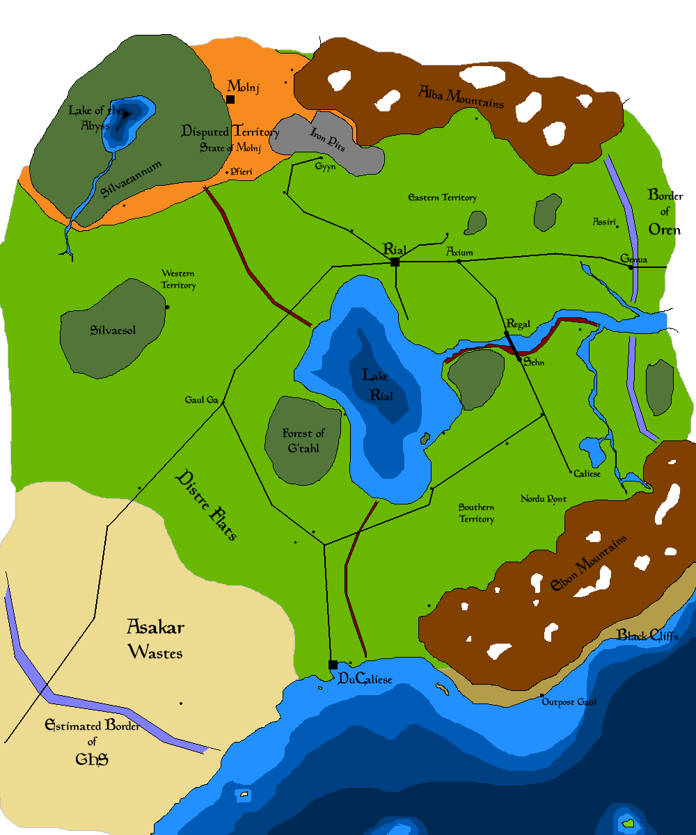
Map of Distre
From Azuwiki
Revision as of 06:10, 29 April 2007 by Sneaky GHoSt (Talk | contribs)
The Principality of Distre as rendered through common knowledge and commonly available records.
Key
- Purple Lines: National Boundaires
- Red Lines: Territorial Boundaries
- Black Lines: Rail Lines
- Black Squares and Dots: Cities and Towns
- Orange Shaded Territory: Disputed Territory by Sepratists

