The Long Mynd
From Ars Magica
Ars Magica (Talk | contribs) (changed image to a locally hosted image.) |
m (additions regarding the hill fort) |
||
| (2 intermediate revisions not shown) | |||
| Line 1: | Line 1: | ||
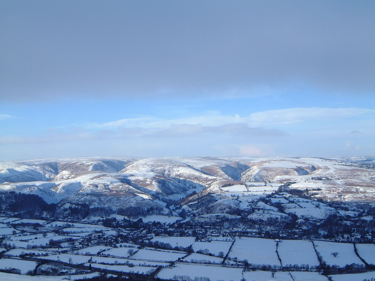
| - | [[Image:longmynd.jpg]] | + | [[Image:longmynd.jpg|thumb|center|600px|The Long Mynd in Winter, click for a much larger image.]] |
I believe this picture shows Carding Valley, directly behind Church Stretton, | I believe this picture shows Carding Valley, directly behind Church Stretton, | ||
with the roman road running before it. Dominating the rear of the picture is the Long Mynd massif. An enormous gurt lump of geography, with many valleys, streams, and an ancient greenway, known as the Portway running along the ridge. | with the roman road running before it. Dominating the rear of the picture is the Long Mynd massif. An enormous gurt lump of geography, with many valleys, streams, and an ancient greenway, known as the Portway running along the ridge. | ||
| + | |||
| + | |||
| + | ===Bodbury Ring=== | ||
| + | |||
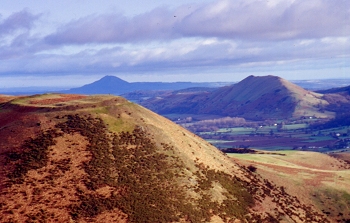
| + | [[Image:Bodbury.jpg|frame|left|Bodbury Hill Fort viewed from the Burway.]] | ||
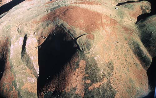
| + | [[Image:Bodbury-aerial.jpg|frame|none|Aerial photograph of Bodbury Ring.]] | ||
| + | |||
| + | One of the nearest archaeological sites to Church Stretton, is the Bodbury Ring. | ||
| + | |||
| + | A small univallate hillfort, survivng from the Iron Age as a ring with a commanding view across the area. It possibly incorporates an earlier cross dyke. The Ring immediately overlooks Carding Mill Valley, on the eastern edge of The Long Mynd. Caer Caradoc (Church Stretton) and The Lawley are to its east, and The Wrekin is obvious on the skyline to the north-east. All these are also the sites of hillforts and settlements. | ||
| + | |||
| + | :[[http://www.megalithic.co.uk/article.php?sid=8395 From the Megalithic Portal and Megalithic Map Website]] | ||
| + | |||
| + | Description: This spectacular aerial photograph shows the strong strategic location of Bodbury Ring Iron Age (700 B.C. - A.D. 43) hillfort near Church Stretton. The steep hill slopes on two of the three sides of this fort would make the settlement very difficult to attack. This photograph is also of interest because it shows a long linear earthwork running away from the hillfort and following the hill summit. This is known as a "cross dyke" and is thought to pre date the hillfort. There are various different interpretations for the function of cross dykes. They might have been used to mark territorial limits or internal boundaries within communities. They might also have been used as trackways, cattle droveways or defensive earthworks. This cross dyke probably dates to the Bronze Age (2300 B.C. - A.D. 43). (Clwyd-Powys Archaeological Trust). | ||
| + | |||
| + | :[[http://www.search.secretshropshire.org.uk/engine/resource/default.asp?theme=1964&originator=%2Fengine%2Ftheme%2Fdefault%2Easp&page=&records=&direction=&pointer=9680&text=0&resource=5275 From the Secret Shropshire Website]] | ||
| + | |||
| + | |||
| + | |||
| + | {| border=1 | | ||
| + | | colspan=4 bgcolor=gainsboro | Nearby archaeological sites (relative to Bodbury Ring): | ||
| + | |- | ||
| + | | 0.7km ||SW ||The Devil's Mouth Cross Dyke || Misc. Earthwork | ||
| + | |- | ||
| + | | 1.9km ||W || Long Mynd A || Round Barrow(s) | ||
| + | |- | ||
| + | | 2.0km ||NW || Robin Hood's Butts (Shropshire) || Round Barrow(s) | ||
| + | |- | ||
| + | | 2.0km ||NE || Castle Hill (Shropshire) || Hillfort | ||
| + | |- | ||
| + | | 2.0km ||N || High Park Cross Dyke || Ancient Village or Settlement | ||
| + | |- | ||
| + | | 2.2km ||W || Boiling Well (Long Mynd) || Round Barrow(s) | ||
| + | |- | ||
| + | | 2.3km ||W || Long Mynd C || Round Barrow(s) | ||
| + | |- | ||
| + | | 2.4km ||W || Shooting Box Disc Barrow || Round Barrow(s) | ||
| + | |- | ||
| + | | 2.8km ||SW || Barrister's Plain Cross Dyke || Ancient Village or Settlement | ||
| + | |- | ||
| + | | 3.2km ||SW || Long Mynd B || Round Barrow(s) | ||
| + | |- | ||
| + | | 3.3km ||E || Caer Caradoc (Church Stretton) || Hillfort | ||
| + | |- | ||
| + | | 3.4km ||W || Pole Cottage || Round Barrow(s) | ||
| + | |- | ||
| + | | 4.6km ||NW || Ratlinghope Hill Camp || Hillfort | ||
| + | |- | ||
| + | | 5.1km ||NW || Castle Ring (Stitt Hill) || Hillfort | ||
| + | |- | ||
| + | | 6.2km ||NW || Leasowes Barrow || Round Barrow(s) | ||
| + | |- | ||
| + | | 6.3km ||SW || Botley Stone || Ring Cairn | ||
| + | |- | ||
| + | | 8.7km ||NW || The Stiperstones || Cairn | ||
| + | |- | ||
| + | | 8.9km ||S || Strefford Henge || Henge | ||
| + | |- | ||
| + | | 9.0km ||NW || The Paddocks || Stone Row / Alignment | ||
| + | |- | ||
| + | | 9.6km ||NW || Castle Ring (Stiperstones) || Hillfort | ||
| + | |} | ||
| + | |||
| + | |||
| + | [[Category:Location]] | ||
| + | [[Category:Physical]] | ||
Current revision as of 09:23, 28 March 2006
I believe this picture shows Carding Valley, directly behind Church Stretton, with the roman road running before it. Dominating the rear of the picture is the Long Mynd massif. An enormous gurt lump of geography, with many valleys, streams, and an ancient greenway, known as the Portway running along the ridge.
Bodbury Ring
One of the nearest archaeological sites to Church Stretton, is the Bodbury Ring.
A small univallate hillfort, survivng from the Iron Age as a ring with a commanding view across the area. It possibly incorporates an earlier cross dyke. The Ring immediately overlooks Carding Mill Valley, on the eastern edge of The Long Mynd. Caer Caradoc (Church Stretton) and The Lawley are to its east, and The Wrekin is obvious on the skyline to the north-east. All these are also the sites of hillforts and settlements.
Description: This spectacular aerial photograph shows the strong strategic location of Bodbury Ring Iron Age (700 B.C. - A.D. 43) hillfort near Church Stretton. The steep hill slopes on two of the three sides of this fort would make the settlement very difficult to attack. This photograph is also of interest because it shows a long linear earthwork running away from the hillfort and following the hill summit. This is known as a "cross dyke" and is thought to pre date the hillfort. There are various different interpretations for the function of cross dykes. They might have been used to mark territorial limits or internal boundaries within communities. They might also have been used as trackways, cattle droveways or defensive earthworks. This cross dyke probably dates to the Bronze Age (2300 B.C. - A.D. 43). (Clwyd-Powys Archaeological Trust).
| Nearby archaeological sites (relative to Bodbury Ring): | |||
| 0.7km | SW | The Devil's Mouth Cross Dyke | Misc. Earthwork |
| 1.9km | W | Long Mynd A | Round Barrow(s) |
| 2.0km | NW | Robin Hood's Butts (Shropshire) | Round Barrow(s) |
| 2.0km | NE | Castle Hill (Shropshire) | Hillfort |
| 2.0km | N | High Park Cross Dyke | Ancient Village or Settlement |
| 2.2km | W | Boiling Well (Long Mynd) | Round Barrow(s) |
| 2.3km | W | Long Mynd C | Round Barrow(s) |
| 2.4km | W | Shooting Box Disc Barrow | Round Barrow(s) |
| 2.8km | SW | Barrister's Plain Cross Dyke | Ancient Village or Settlement |
| 3.2km | SW | Long Mynd B | Round Barrow(s) |
| 3.3km | E | Caer Caradoc (Church Stretton) | Hillfort |
| 3.4km | W | Pole Cottage | Round Barrow(s) |
| 4.6km | NW | Ratlinghope Hill Camp | Hillfort |
| 5.1km | NW | Castle Ring (Stitt Hill) | Hillfort |
| 6.2km | NW | Leasowes Barrow | Round Barrow(s) |
| 6.3km | SW | Botley Stone | Ring Cairn |
| 8.7km | NW | The Stiperstones | Cairn |
| 8.9km | S | Strefford Henge | Henge |
| 9.0km | NW | The Paddocks | Stone Row / Alignment |
| 9.6km | NW | Castle Ring (Stiperstones) | Hillfort |


