The Setting
From Ars Magica
(→Random Notes) |
m (→Maps of all or part of Britain: - converted to a gallery.) |
||
| (30 intermediate revisions not shown) | |||
| Line 1: | Line 1: | ||
| + | ---- | ||
| + | =Local Medieval History and Geography= | ||
==Where are we?== | ==Where are we?== | ||
| Line 4: | Line 6: | ||
| - | The game begins with the players and their retinue arriving at an inn in the small | + | The game begins with the players and their retinue arriving at an inn in the small hamlet of Church Stretton. |
Little Stretton, Church Stretton, and All Stretton, are three small settlements that form the manor of Stretton-en-le-Dale. The central and largest settlement, where the church was built, is the small market town of Church Stretton, some 19 km. (12 miles/4 leagues). south-southwest of Shrewsbury and 20 km. (12 1/2 miles/4 leagues) north-north-west of Ludlow. The village is dominated by the huge Long Mynd massif, which provides Church Stretton with both its views, and good, fresh spring water. | Little Stretton, Church Stretton, and All Stretton, are three small settlements that form the manor of Stretton-en-le-Dale. The central and largest settlement, where the church was built, is the small market town of Church Stretton, some 19 km. (12 miles/4 leagues). south-southwest of Shrewsbury and 20 km. (12 1/2 miles/4 leagues) north-north-west of Ludlow. The village is dominated by the huge Long Mynd massif, which provides Church Stretton with both its views, and good, fresh spring water. | ||
| Line 14: | Line 16: | ||
The Long Mynd, or 'Long Mountain', is a ridge of high ground in South Shropshire, running roughly SW to NE, and extending some 15 km. (9 miles/3 leagues) in length, between the Stiperstones to the west, and Wenlock Edge to the east. The rock is pre-Cambrian, though not as old as the volcanic rock of the Stretton hills (Lawley, Caradoc and Ragleth) to the east. The highest point is Pole Bank, 516m. (1693 ft.) above sea level. An ancient track, the Portway, runs along the top of the ridge. | The Long Mynd, or 'Long Mountain', is a ridge of high ground in South Shropshire, running roughly SW to NE, and extending some 15 km. (9 miles/3 leagues) in length, between the Stiperstones to the west, and Wenlock Edge to the east. The rock is pre-Cambrian, though not as old as the volcanic rock of the Stretton hills (Lawley, Caradoc and Ragleth) to the east. The highest point is Pole Bank, 516m. (1693 ft.) above sea level. An ancient track, the Portway, runs along the top of the ridge. | ||
| - | ==Geological Information== | + | |
| + | ---- | ||
| + | |||
| + | ==Geological Information about Church Stretton== | ||
The parish's geology is almost entirely PreCambrian. The principal feature is the Church Stretton Fault running along the east side of the dale. East of the fault, broadly speaking, the hills are formed of what, apart from some small areas of schists near the Wrekin, are Shropshire's oldest rocks, the Uriconian volcanics: mainly Ragleth Tuffs, though Caer Caradoc's geology is complicated by Caer Caradoc Andesites and Cwms Rhyolites with intrusive igneous Dolerite. West of the fault the younger Longmyndian sedimentary rocks from the Long Mynd, their strata dipping almost vertically to the northwest, throwing up the Stretton Series of fine-grained siltstones and a thin band of Cardingmill Grit and, further west and beyond the parish boundary, the newer coarse-grained Wentnor Series; the higher parts of the Long Mynd are covered with head and, between All Stretton and Colliers Lye, areas of boulder clay. In the centre of the dale Longmyndian rocks are exposed on both sides of the fault so that Stretton Shales from the lowest slopes not only of the Long Mynd but also of Ragleth and Helmeth hills and the south-western slope of Caer Caradoc hill; on the western slopes of the eastern hills, though not on the Long Mynd, Helmeth Grit, oldest of the Longmyndian rocks, appears from beneath the Stretton Shales. Small areas at the south end of Ragleth hill (around Wiresytch coppice) and at the eastern end of Minton township (around Queensbatch mill and Marshbrook) are Ordovician: Caradoc shales, flags, and sandstone. The floor of the dale consists of glacial deposits of boulder clay overlying Silurian shales and limestone; some of those shales, of the Llandovery and Wenlock Series, are exposed in the southern part of the dale, particularly around Minton. There are alluvial deposits along the courses of the streams and, here and there, islands of sand and gravel. Coal Measures have been encountered near Botvyle. | The parish's geology is almost entirely PreCambrian. The principal feature is the Church Stretton Fault running along the east side of the dale. East of the fault, broadly speaking, the hills are formed of what, apart from some small areas of schists near the Wrekin, are Shropshire's oldest rocks, the Uriconian volcanics: mainly Ragleth Tuffs, though Caer Caradoc's geology is complicated by Caer Caradoc Andesites and Cwms Rhyolites with intrusive igneous Dolerite. West of the fault the younger Longmyndian sedimentary rocks from the Long Mynd, their strata dipping almost vertically to the northwest, throwing up the Stretton Series of fine-grained siltstones and a thin band of Cardingmill Grit and, further west and beyond the parish boundary, the newer coarse-grained Wentnor Series; the higher parts of the Long Mynd are covered with head and, between All Stretton and Colliers Lye, areas of boulder clay. In the centre of the dale Longmyndian rocks are exposed on both sides of the fault so that Stretton Shales from the lowest slopes not only of the Long Mynd but also of Ragleth and Helmeth hills and the south-western slope of Caer Caradoc hill; on the western slopes of the eastern hills, though not on the Long Mynd, Helmeth Grit, oldest of the Longmyndian rocks, appears from beneath the Stretton Shales. Small areas at the south end of Ragleth hill (around Wiresytch coppice) and at the eastern end of Minton township (around Queensbatch mill and Marshbrook) are Ordovician: Caradoc shales, flags, and sandstone. The floor of the dale consists of glacial deposits of boulder clay overlying Silurian shales and limestone; some of those shales, of the Llandovery and Wenlock Series, are exposed in the southern part of the dale, particularly around Minton. There are alluvial deposits along the courses of the streams and, here and there, islands of sand and gravel. Coal Measures have been encountered near Botvyle. | ||
| Line 20: | Line 25: | ||
From: 'Church Stretton', A History of the County of Shropshire: Volume 10: Munslow Hundred (part), The Liberty and Borough of Wenlock (1998), pp. 72-120. URL: http://british.history.ac.uk/report.asp?compid=22861. Date accessed: 26 January 2006. | From: 'Church Stretton', A History of the County of Shropshire: Volume 10: Munslow Hundred (part), The Liberty and Borough of Wenlock (1998), pp. 72-120. URL: http://british.history.ac.uk/report.asp?compid=22861. Date accessed: 26 January 2006. | ||
| - | |||
| + | ---- | ||
| + | == Shrewsbury == | ||
| - | + | *[[Shrewsbury]]/Shewsbury/Shrewesbury/Sarop/Salop is the nearest major town to the player's starting location. | |
| - | + | == The County of Shropshire == | |
| - | The | + | === The History of Shropshire === |
| - | + | [[History of Shropshire]] from the 1911 Encyclopaedia Britanica | |
| - | + | === Locations in Shropshire === | |
| + | {{Gazeteer}} | ||
| - | + | Edit the [[Template:Gazeteer]] | |
| - | + | === Maps of Shropshire === | |
| - | + | Immediate area [[around Church Stretton]] | |
| + | [[Image:map_shropshire_01.gif]] | ||
| + | [[Image:shropshire_map.gif]] | ||
| - | + | ====A map of just Shropshire, showing Shrewsbury and the Strettons==== | |
| + | [[Image:Shropshire.jpg|center|thumb|500px|Click for an excellent, very high resolution map. n.b. hills are heavily stylised.]]<br> | ||
| - | |||
| - | === | + | ---- |
| + | ====A series of blank maps of the local area==== | ||
| + | <small>These images were created using the two interactive map websites that can be found in [[OOC links]]. Feel free to use these, or create new maps, for any purpose that springs to mind, such as vis sources, covenant locations, etcetera. Change them as you like.</small> | ||
| - | + | <center><gallery> | |
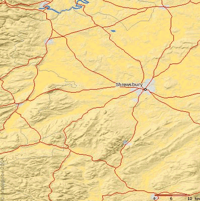
| - | + | Image:localmap1.gif|A top down map of the larger area. | |
| - | + | Image:localmap2.gif|A top down map of the immediate area. | |
| - | + | Image:localmap3.gif|An angled map of the immediate area. | |
| - | + | Image:localmap4.gif|An angled map of the larger area. | |
| + | </gallery></center> | ||
| + | == Maps of all or part of Britain == | ||
| + | <small>Click on the following thumbnails for full-size versions. The largest files will present you with an intermediate-size thumbnail, and the option of downloading the very high resolution version of the picture.</small> | ||
| + | ---- | ||
| + | <center><gallery> | ||
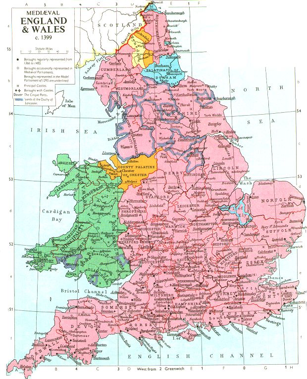
| + | image:1399englanda.jpg|A map of England in the year 1399. | ||
| + | image:Image5.jpg|left|thumb|120px|A map showing castle locations. | ||
| + | image:Image3.jpg|A map showing castle locations.]] | ||
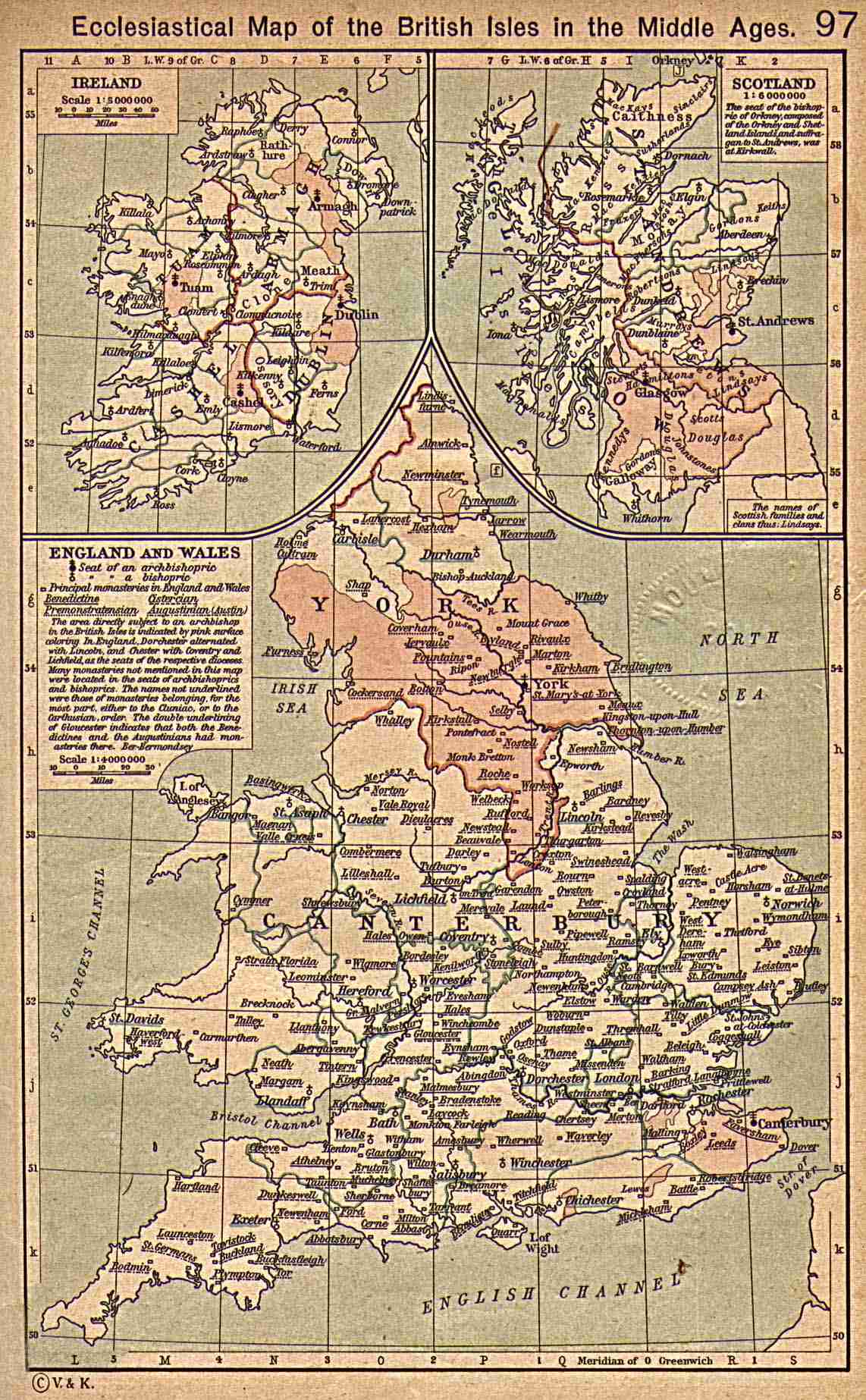
| + | image:Ecclesiastical_Brit_Isles.jpg|An ecclesiastical map of the British Isles. | ||
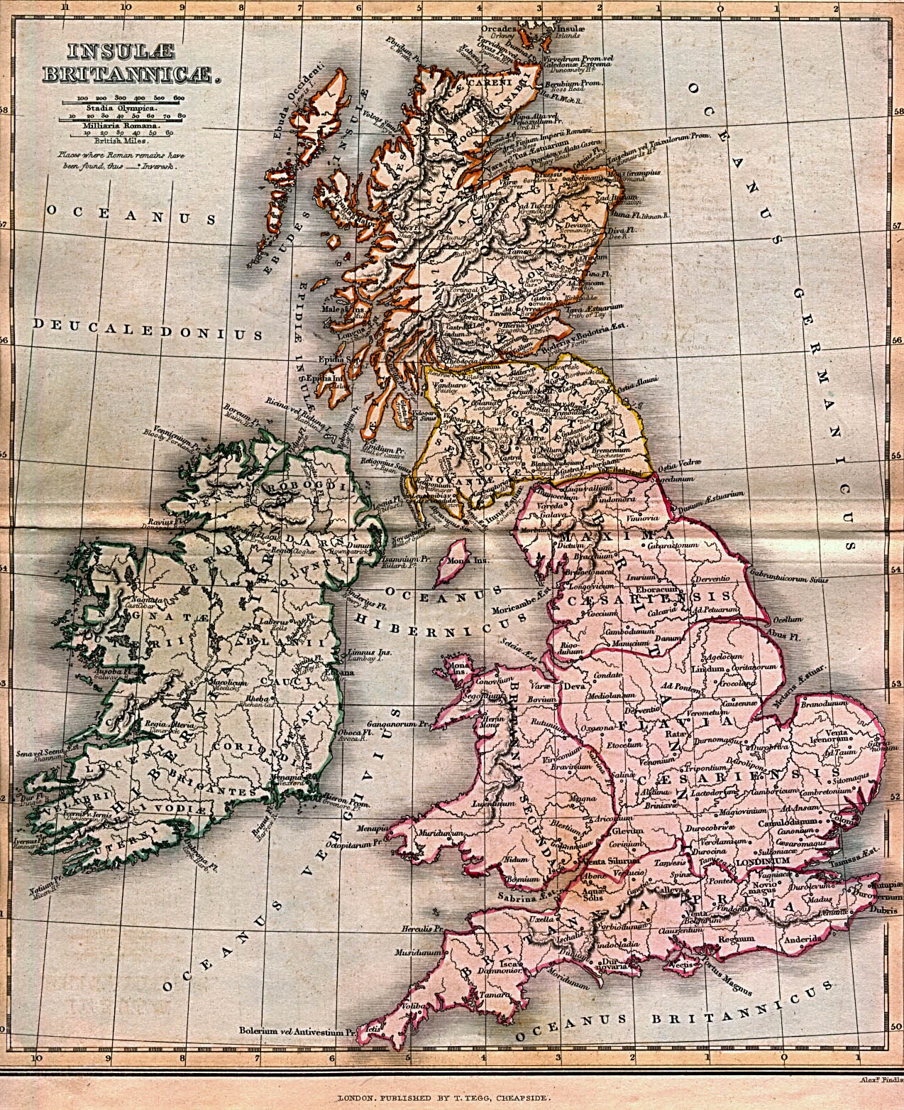
| + | image:ancient_britannia_1852.jpg|Ancient Brittanica - 1852. | ||
| + | </gallery></center> | ||
| + | ---- | ||
| + | == Maps of all or part of Europe == | ||
| - | + | [[image:Europe_1200.jpg|center|thumb|600px|A political map of Europe in the year 1200.]] | |
| - | + | ||
| - | + | ---- | |
| - | + | ||
| - | + | ||
| - | + | ||
| - | + | =English Medieval History= | |
| - | + | ||
| - | + | ||
| - | + | ||
| - | + | ||
| - | + | <big> | |
| + | *[[Kings of England|Reigns of the Plantagenets]] | ||
| - | + | *[[The Church of the 12th-13th Century]] | |
| - | + | ||
| - | + | ||
| - | + | ||
| - | + | ||
| - | + | ||
| - | + | ||
| - | + | ||
| - | + | *[[A glossary of Medieval Terms]] | |
| - | + | *[[A timeline of events in the Medieval Period]] | |
| - | + | </big> | |
| - | + | ||
| - | + | ||
| - | + | ||
| - | + | ||
| - | + | ||
| - | + | ||
| - | + | ||
| - | + | ||
| - | + | ||
| - | + | ||
| - | + | ||
| - | + | ||
| - | + | ||
| - | + | ||
| - | + | ||
| - | + | ||
| - | + | ||
| - | + | ||
| - | + | ||
| - | + | ||
| - | + | ||
| - | + | ||
| - | + | ||
| - | + | ||
| - | + | ||
| - | + | ||
| - | + | ||
| - | + | ||
| - | + | ||
| - | + | ||
| - | + | ||
| - | + | ||
Current revision as of 18:41, 15 March 2006
Contents |
Local Medieval History and Geography
Where are we?
The game begins with the players and their retinue arriving at an inn in the small hamlet of Church Stretton.
Little Stretton, Church Stretton, and All Stretton, are three small settlements that form the manor of Stretton-en-le-Dale. The central and largest settlement, where the church was built, is the small market town of Church Stretton, some 19 km. (12 miles/4 leagues). south-southwest of Shrewsbury and 20 km. (12 1/2 miles/4 leagues) north-north-west of Ludlow. The village is dominated by the huge Long Mynd massif, which provides Church Stretton with both its views, and good, fresh spring water.
All the settlements lie near, but not on, the Roman road from Deva (Chester) via Viroconium Cornoviorum (Wroxeter) to Isca (Caerleon, Mon.) The road, itself known as Botte (Bot) Street, gave a name to the three Strettons, All Stretton apparently taking its particular name from one Alfred, the nature of whose connection with the settlement is not known.
Between Little Stretton and Church Stretton lies Brockhurst Hill, upon which a modest castle has been newly constructed to watch over the roman road.
The Long Mynd, or 'Long Mountain', is a ridge of high ground in South Shropshire, running roughly SW to NE, and extending some 15 km. (9 miles/3 leagues) in length, between the Stiperstones to the west, and Wenlock Edge to the east. The rock is pre-Cambrian, though not as old as the volcanic rock of the Stretton hills (Lawley, Caradoc and Ragleth) to the east. The highest point is Pole Bank, 516m. (1693 ft.) above sea level. An ancient track, the Portway, runs along the top of the ridge.
Geological Information about Church Stretton
The parish's geology is almost entirely PreCambrian. The principal feature is the Church Stretton Fault running along the east side of the dale. East of the fault, broadly speaking, the hills are formed of what, apart from some small areas of schists near the Wrekin, are Shropshire's oldest rocks, the Uriconian volcanics: mainly Ragleth Tuffs, though Caer Caradoc's geology is complicated by Caer Caradoc Andesites and Cwms Rhyolites with intrusive igneous Dolerite. West of the fault the younger Longmyndian sedimentary rocks from the Long Mynd, their strata dipping almost vertically to the northwest, throwing up the Stretton Series of fine-grained siltstones and a thin band of Cardingmill Grit and, further west and beyond the parish boundary, the newer coarse-grained Wentnor Series; the higher parts of the Long Mynd are covered with head and, between All Stretton and Colliers Lye, areas of boulder clay. In the centre of the dale Longmyndian rocks are exposed on both sides of the fault so that Stretton Shales from the lowest slopes not only of the Long Mynd but also of Ragleth and Helmeth hills and the south-western slope of Caer Caradoc hill; on the western slopes of the eastern hills, though not on the Long Mynd, Helmeth Grit, oldest of the Longmyndian rocks, appears from beneath the Stretton Shales. Small areas at the south end of Ragleth hill (around Wiresytch coppice) and at the eastern end of Minton township (around Queensbatch mill and Marshbrook) are Ordovician: Caradoc shales, flags, and sandstone. The floor of the dale consists of glacial deposits of boulder clay overlying Silurian shales and limestone; some of those shales, of the Llandovery and Wenlock Series, are exposed in the southern part of the dale, particularly around Minton. There are alluvial deposits along the courses of the streams and, here and there, islands of sand and gravel. Coal Measures have been encountered near Botvyle.
From: 'Church Stretton', A History of the County of Shropshire: Volume 10: Munslow Hundred (part), The Liberty and Borough of Wenlock (1998), pp. 72-120. URL: http://british.history.ac.uk/report.asp?compid=22861. Date accessed: 26 January 2006.
Shrewsbury
- Shrewsbury/Shewsbury/Shrewesbury/Sarop/Salop is the nearest major town to the player's starting location.
The County of Shropshire
The History of Shropshire
History of Shropshire from the 1911 Encyclopaedia Britanica
Locations in Shropshire
Information garnered from various modern sources about the area of the time of the campaign.
Acton,
Acton Castle,
All Stretton,
Bishop's Castle,
Brockhurst Castle,
Cheyney Longville,
Clun,
Clun Castle,
Craven Arms,
Church Stretton,
Little Stretton,
Long Mynd,
Ludlow,
Ludlow Castle,
Much Wenlock,
Newton,
Norton Camp,
Shrewsbury,
Shrewsbury Castle,
Stokesay Castle,
Wenlock Edge,
Wistanstow,
Edit the Template:Gazeteer
Maps of Shropshire
Immediate area around Church Stretton
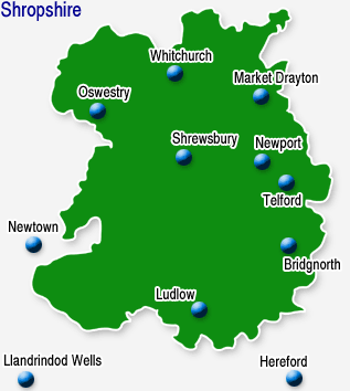
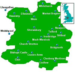
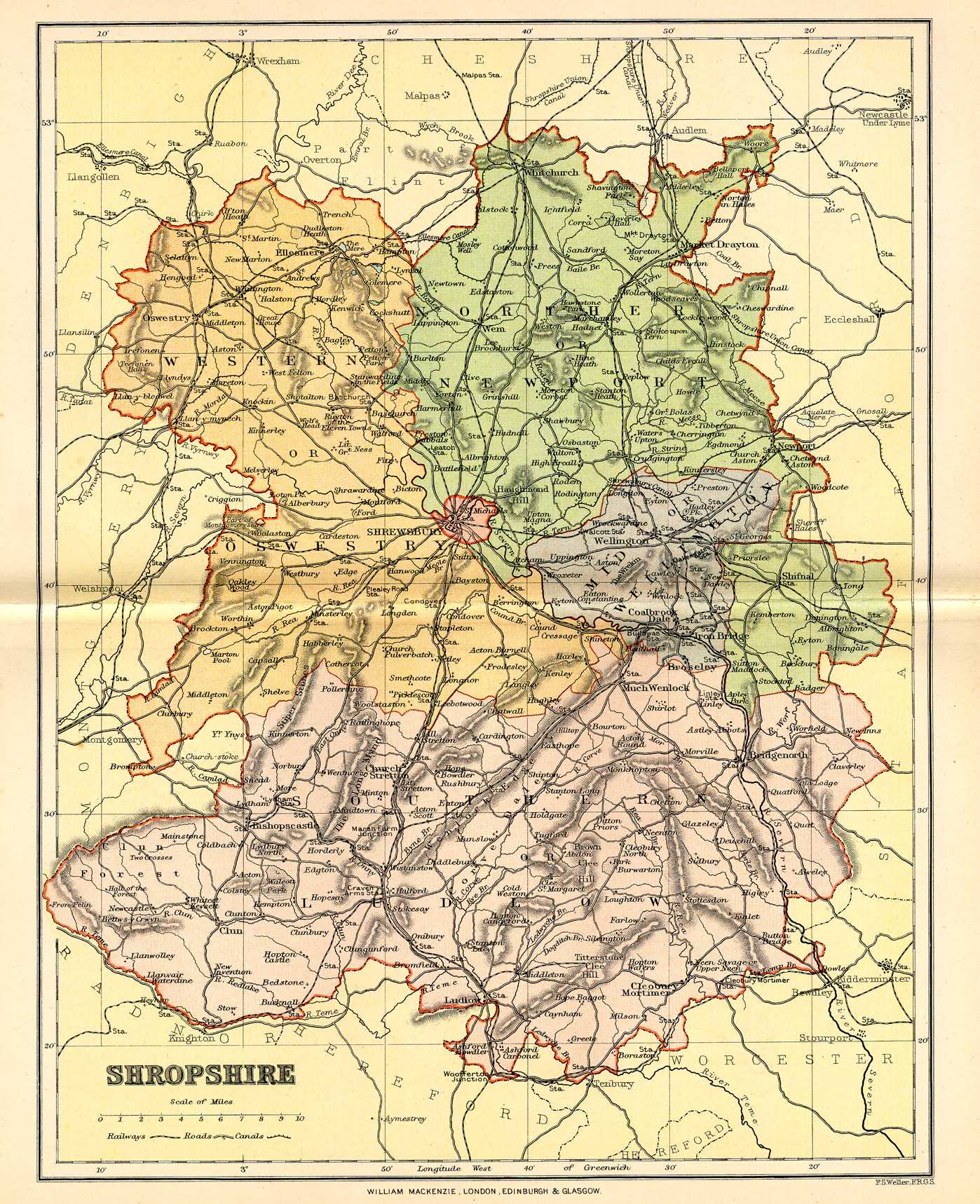
A map of just Shropshire, showing Shrewsbury and the Strettons
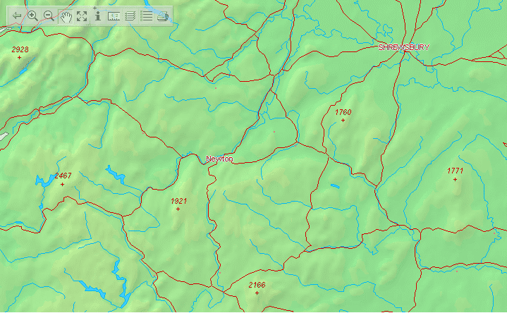
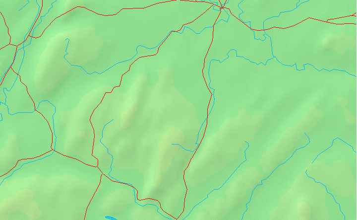
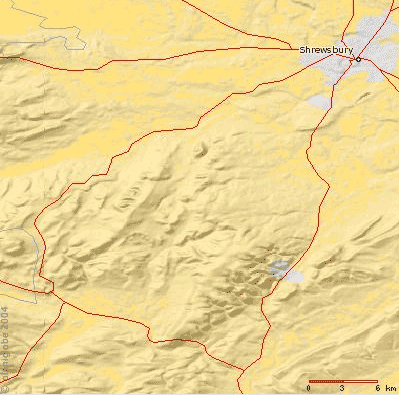
A series of blank maps of the local area
These images were created using the two interactive map websites that can be found in OOC links. Feel free to use these, or create new maps, for any purpose that springs to mind, such as vis sources, covenant locations, etcetera. Change them as you like.
Maps of all or part of Britain
Click on the following thumbnails for full-size versions. The largest files will present you with an intermediate-size thumbnail, and the option of downloading the very high resolution version of the picture.
Maps of all or part of Europe
English Medieval History
